


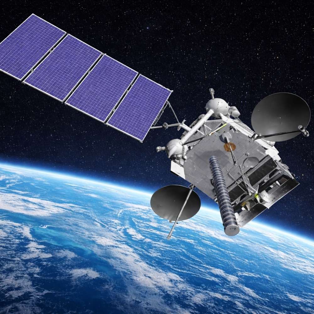
Elektro-L Weather Satellites
Russia’s Geostationary Weather Sentinel
Quick Reader
| Attribute | Details |
|---|---|
| Mission Name | Elektro-L |
| Operator | Roscosmos / Roshydromet |
| Country | Russia |
| Orbit Type | Geostationary Earth Orbit (GEO) |
| Orbital Longitude | Varies by satellite (e.g., ~76°E, ~14.5°W) |
| First Launch | 20 January 2011 (Elektro-L No.1) |
| Mission Type | Meteorological & environmental monitoring |
| Primary Coverage | Russia, Europe, Asia, Indian Ocean |
| Key Instrument | MSU-GS (Multispectral Imager) |
| Mission Status | Operational (multiple satellites, mixed health) |
Scientific & Operational Role
Elektro-L is Russia’s primary geostationary meteorological satellite system, providing continuous weather monitoring and Earth observation across Eurasia.
Why It Matters
Elektro-L restored Russia’s independent GEO weather capability and integrated the country into the global real-time meteorological satellite network.
Introduction – Why Elektro-L Was Necessary
For years after the Soviet era, Russia lacked a modern geostationary weather satellite. This created a major gap:
Limited real-time storm tracking
Dependence on foreign satellite data
Reduced forecasting accuracy over vast territories
Elektro-L was designed to close that gap.
By placing advanced meteorological satellites in geostationary orbit, Russia regained the ability to observe weather systems continuously, rather than in brief snapshots.
Mission Purpose – Continuous Weather, Not Occasional Images
Elektro-L was built with a clear philosophy:
Weather is a process, not a picture.
The mission focuses on:
Continuous cloud motion tracking
Storm development and cyclone monitoring
Environmental and atmospheric observation
Unlike low-Earth orbit weather satellites, Elektro-L remains fixed over a region, allowing time-resolved monitoring of dynamic systems.
Orbit and Coverage – Watching Half the World
Operating from geostationary orbit, Elektro-L satellites can observe:
Most of Russia’s territory
Large parts of Europe and Asia
The Indian Ocean and surrounding regions
This positioning allows:
Early detection of severe weather
Continuous monitoring of large-scale systems
Integration with international forecasting models
For a country spanning multiple climate zones, this persistent view is essential.
MSU-GS – The Eye of Elektro-L
The heart of the mission is the MSU-GS multispectral scanning radiometer.
Key capabilities:
Visible and infrared imaging
Multiple spectral channels
Continuous Earth disk observation
MSU-GS enables:
Cloud type and height determination
Surface and sea temperature mapping
Monitoring of atmospheric moisture
This instrument places Elektro-L in the same functional category as GOES and Meteosat, though with different technical design choices.
What Elektro-L Observes
Elektro-L supports a wide range of applications:
Cyclone and storm tracking
Fog and cloud cover monitoring
Wildfire detection
Snow and ice extent observation
Environmental change assessment
These datasets are used by:
National weather services
Aviation and maritime operations
Disaster management agencies
Why Geostationary Orbit Is Essential for Elektro-L
Electro-L’s mission would not work from low Earth orbit.
GEO allows:
Constant view of the same region
Animation of weather evolution
Rapid update cycles
This is especially important for:
Fast-developing storms
Tropical cyclones
Severe weather warnings
Persistence, not resolution, is the mission’s priority.
Elektro-L in the Global Weather Network
Modern weather forecasting relies on international data sharing.
Elektro-L contributes to:
Global numerical weather prediction models
Cross-calibration with other GEO satellites
Worldwide meteorological cooperation
Together with GOES, Meteosat, Himawari, and INSAT, Elektro-L forms part of a planet-scale weather observation ring.
Why Elektro-L Matters Today
Elektro-L matters because it:
Restored Russia’s GEO weather capability
Supports forecasting over a massive land area
Contributes to global climate and weather models
Demonstrates independent space-based infrastructure
It is not just a satellite—it is national and global meteorological infrastructure.
The Elektro-L Satellite Series – Evolution Over Time
Elektro-L is not a single spacecraft but a series of geostationary meteorological satellites, each intended to improve coverage, reliability, and data quality.
Known Missions in the Series
Elektro-L No.1 (2011) – Restored Russia’s GEO weather presence
Elektro-L No.2 (2015) – Improved reliability and continuity
Elektro-L No.3 (2019) – Updated systems, mixed operational success
The long-term plan envisioned continuous replacement, ensuring uninterrupted geostationary coverage—an approach used by all major weather-satellite operators.
Technical Architecture – Built for Persistence
Elektro-L satellites are designed around a core requirement: continuous operation.
Key architectural features include:
Three-axis stabilization for precise pointing
High-gain antennas for constant data downlink
Redundant subsystems to extend operational life
Unlike experimental missions, Elektro-L platforms prioritize:
Reliability over novelty
Data continuity over short-term performance peaks
This philosophy reflects the operational nature of meteorological satellites.
Imaging Performance – Strengths and Trade-Offs
The MSU-GS instrument provides full-disk Earth imagery across visible and infrared bands.
Strengths
Continuous monitoring of large-scale systems
Frequent update cycles
Effective cloud and storm tracking
Limitations
Lower spatial resolution compared to some newer GEO systems
Fewer spectral channels than next-generation satellites
Gradual degradation in some instruments over time
These trade-offs are typical of GEO satellites launched during the early 2010s.
Operational Challenges and Setbacks
Elektro-L has faced technical challenges, particularly with later satellites.
Reported issues include:
Instrument degradation
Partial payload failures
Reduced imaging performance in some channels
However, these challenges:
Did not eliminate overall mission value
Provided engineering feedback for future designs
Highlighted the difficulty of long-duration GEO operations
Weather satellites are expected to operate continuously for years in a harsh radiation environment—setbacks are not uncommon.
Elektro-L vs Other Major GEO Weather Systems
Comparison with Global Counterparts
| Feature | Elektro-L | GOES-R (USA) | Meteosat (Europe) | Himawari (Japan) |
|---|---|---|---|---|
| Primary Region | Eurasia | Americas | Europe & Africa | Asia-Pacific |
| Imaging Update Rate | Moderate | Very high | High | Very high |
| Spectral Channels | Moderate | Extensive | Extensive | Extensive |
| Mission Focus | National + global | Operational excellence | Climate & weather | Rapid monitoring |
Interpretation
Elektro-L emphasizes regional operational coverage, while newer systems prioritize ultra-fast updates and expanded spectral analysis.
Why Elektro-L Still Plays a Vital Role
Even with technical limitations, Elektro-L remains important because:
Weather forecasting depends on continuous coverage, not perfection
Redundancy across global systems improves forecast accuracy
Regional satellites provide context-specific observations
In global meteorology, overlapping capabilities are a strength, not a weakness.
Data Use and Distribution
Elektro-L data supports:
Russian national weather forecasts
Aviation and maritime safety
Climate monitoring initiatives
International numerical weather models
By contributing to shared datasets, Elektro-L enhances global forecasting reliability, even outside its primary coverage zone.
What Elektro-L Teaches About GEO Weather Missions
The Elektro-L experience highlights key lessons:
GEO missions demand long-term system resilience
Instrument longevity is as important as raw performance
Weather satellites must balance ambition with reliability
These lessons influence the design of future Russian meteorological spacecraft.
Long-Term Legacy – Rebuilding a Geostationary Capability
Elektro-L’s most important achievement was not a single discovery, but capability restoration.
By deploying a functioning series of geostationary weather satellites, Russia:
Re-established independent real-time meteorological monitoring
Reduced reliance on foreign GEO data
Rejoined the global network of continuous weather observation
This capability is essential for a country spanning vast latitudes, climates, and weather regimes.
Why Elektro-L Matters in Daily Forecasting
Weather forecasting is cumulative.
Elektro-L contributes by:
Providing continuous cloud-motion vectors
Tracking large-scale atmospheric circulation
Feeding numerical weather prediction models
Even when resolution is not state-of-the-art, temporal continuity makes the data valuable. Forecast models improve when they ingest consistent, long-duration observations.
Elektro-L and Disaster Risk Reduction
One of the mission’s most practical roles is supporting early warning systems.
Elektro-L data is used for:
Cyclone and severe storm monitoring
Flood risk assessment
Wildfire detection and tracking
Maritime and aviation safety
Persistent observation allows authorities to see hazards develop, not just react after they form.
Frequently Asked Questions (FAQ)
Is Elektro-L still operational?
Yes. Multiple Elektro-L satellites have operated in GEO, though individual spacecraft have experienced varying levels of performance over time.
How does Elektro-L differ from Soviet-era weather satellites?
Earlier systems relied heavily on low-Earth orbit platforms. Elektro-L provides continuous, fixed-region observation from geostationary orbit.
Does Elektro-L observe the entire Earth?
No. Like all GEO satellites, it observes a fixed region centered on its orbital longitude, with limited polar visibility.
Why are multiple Elektro-L satellites needed?
GEO weather coverage requires continuity. Multiple spacecraft ensure redundancy and long-term data availability.
Is Elektro-L used outside Russia?
Yes. Its data contributes to international meteorological models and collaborative forecasting efforts.
Elektro-L in the Future Russian Space Architecture
Elektro-L is a stepping stone, not an endpoint.
Future Russian meteorological plans aim to:
Improve imaging resolution
Expand spectral coverage
Increase reliability and redundancy
Integrate more tightly with polar-orbiting systems
Lessons from Elektro-L directly inform these next-generation designs.
Why Geostationary Weather Satellites Remain Essential
Elektro-L reinforces a broader truth:
Weather cannot be understood in snapshots.
Only geostationary satellites can:
Observe storms continuously
Track atmospheric motion in real time
Provide rapid updates for warning systems
LEO satellites complement GEO—but cannot replace it.
What We Would Lose Without Elektro-L
Without Elektro-L:
Regional forecast accuracy over Eurasia would decline
Data redundancy in global models would weaken
Severe weather warnings would have less lead time
In global meteorology, missing data degrades everyone’s forecasts.
Related Topics for Universe Map
Geostationary Satellites
Weather Satellites
GOES
Meteosat
Himawari
Numerical Weather Prediction
Space-Based Disaster Monitoring
Together, these topics explain how continuous observation underpins modern weather science.
Final Perspective
Elektro-L is not the most advanced weather satellite ever built—but it is one of the most important for the region it serves.
By restoring geostationary weather coverage, it returned continuity, autonomy, and resilience to Russian meteorology while strengthening the global forecasting system.
In weather science, presence matters as much as performance.
Elektro-L ensured that presence never disappeared.