


MSG-3
The Silent Guardian of Continuous Weather Observation
Quick Reader
| Attribute | Details |
|---|---|
| Mission Name | Meteosat Second Generation-3 (MSG-3) |
| Alternate Name | Meteosat-10 |
| Operator | EUMETSAT |
| Space Agency | ESA / EUMETSAT |
| Launch Date | 5 July 2012 |
| Launch Vehicle | Ariane 5 |
| Orbit Type | Geostationary Earth Orbit (GEO) |
| Orbital Longitude | ~0° (prime position) |
| Mission Type | Operational meteorological satellite |
| Primary Instrument | SEVIRI imager |
| Mission Status | Operational (backup / support roles) |
Scientific & Operational Role
MSG-3 is a core component of Europe’s real-time weather monitoring infrastructure, providing continuous atmospheric observation over Europe, Africa, and surrounding oceans.
Why It Matters
MSG-3 ensures data continuity, redundancy, and reliability—three pillars of operational meteorology that are as important as raw performance.
Introduction — Why MSG-3 Exists
Weather satellites are not flown for experiments.
They are flown for continuity.
MSG-3 was never designed to be a headline-grabbing mission. Its purpose is far more critical and far more demanding:
Maintain uninterrupted weather coverage
Back up primary operational satellites
Guarantee long-term data stability for forecasting models
In modern meteorology, a single missed observation can propagate errors across numerical weather prediction systems. MSG-3 exists to ensure that never happens.
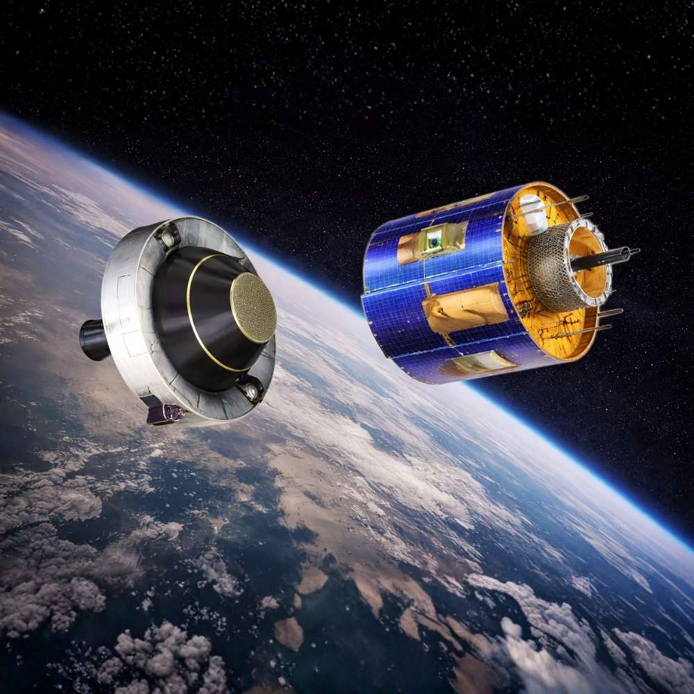
What Is MSG-3?
MSG-3 is the third satellite in the Meteosat Second Generation fleet, operated by EUMETSAT.
It is part of Europe’s core geostationary weather monitoring infrastructure, watching the same hemisphere of Earth 24 hours a day, every day.
Unlike polar-orbiting satellites that scan Earth in strips, MSG-3 remains fixed above the equator, rotating with Earth itself. This allows it to observe atmospheric motion in real time, making it indispensable for:
Storm tracking
Cloud evolution analysis
Severe weather warning systems
Geostationary Orbit — Why Position Matters
MSG-3 operates in Geostationary Earth Orbit (GEO), approximately 35,786 km above the equator.
Why GEO Is Essential
From this altitude:
The satellite matches Earth’s rotation
The same region stays permanently in view
Images are captured every 5–15 minutes
This continuous perspective is critical for:
Monitoring rapidly developing thunderstorms
Tracking cyclones and tropical systems
Observing atmospheric dynamics over oceans and continents
MSG-3 covers Europe, Africa, the Middle East, and large oceanic regions, providing essential data to national meteorological agencies across multiple continents.
The Role of MSG-3 in the MSG Constellation
The Meteosat Second Generation system was designed as a constellation, not as single satellites acting alone.
Within this system:
One satellite serves as primary operational
Another serves as hot backup
Additional satellites provide redundancy and orbital flexibility
MSG-3’s role is to step in instantly if:
The primary satellite fails
Instruments degrade
Orbital relocation becomes necessary
This redundancy ensures zero-gap weather observation, a non-negotiable requirement for aviation, shipping, disaster response, and climate monitoring.
Core Instruments Onboard MSG-3
SEVIRI — Spinning Enhanced Visible and Infrared Imager
SEVIRI is the heart of MSG-3.
It observes Earth in:
12 spectral channels (visible, near-infrared, infrared)
Multiple atmospheric layers simultaneously
SEVIRI allows scientists to:
Track cloud motion and height
Detect fog, dust storms, and volcanic ash
Monitor surface temperatures and water vapor
Its high temporal resolution enables time-lapse atmospheric analysis, something no ground-based system can replicate.
GERB — Geostationary Earth Radiation Budget
GERB measures:
Incoming solar radiation
Reflected shortwave radiation
Emitted longwave radiation
These measurements are essential for:
Climate energy-balance studies
Understanding Earth’s radiation budget
Long-term climate model validation
MSG-3 thus contributes not only to daily forecasts, but also to decades-long climate records.
Launch and Deployment
MSG-3 was launched on 5 July 2012 aboard an Ariane 5 rocket from Kourou, French Guiana.
After launch:
The satellite performed orbital maneuvers to reach GEO
Instruments were calibrated over several months
It entered operational readiness as part of the MSG fleet
Its deployment strengthened Europe’s ability to maintain weather data continuity through the 2010s and beyond.
Why MSG-3 Matters (Even When You Don’t Notice It)
MSG-3 is rarely visible to the public, yet its data silently supports:
Daily weather forecasts
Severe storm warnings
Aviation route safety
Maritime navigation
Climate monitoring and research
When forecasts are accurate, MSG-3 is part of the reason why.
Its greatest success is invisibility — doing its job so reliably that failures never make headlines.
From Space to Forecast — How MSG-3 Data Is Used
MSG-3’s value is measured not by the satellite itself, but by what its data enables on Earth.
Every image and radiance measurement feeds directly into operational meteorology pipelines that power forecasts across Europe, Africa, and beyond.
The Data Flow
SEVIRI scans Earth every 5–15 minutes in 12 spectral channels
Raw measurements are calibrated and geo-referenced by EUMETSAT
Products are distributed in near real time to national weather services
Data is assimilated into global and regional forecast models
Within minutes, MSG-3 observations become part of the decision-making backbone for aviation, shipping, emergency services, and public weather alerts.
Numerical Weather Prediction (NWP) — Continuity Above All
Modern forecasts rely on Numerical Weather Prediction (NWP), where small errors can grow rapidly.
For these systems, consistency matters as much as accuracy.
MSG-3 ensures:
Stable calibration across years
Identical viewing geometry to its sibling satellites
No sudden data gaps that could destabilize models
This is why backup satellites like MSG-3 are mission-critical. If the primary imager fails even briefly, forecast skill can degrade within hours.
Model Assimilation
MSG-3 data is routinely ingested by:
ECMWF global models
Regional mesoscale models across Europe and Africa
Nowcasting systems for severe storms and flash floods
These models depend on MSG-3’s high temporal resolution to track fast-changing atmospheric features.
What MSG-3 Sees That Ground Systems Cannot
1. Rapid Atmospheric Motion
From geostationary orbit, MSG-3 captures:
Cloud development and decay
Jet-stream wave patterns
Convective storm initiation
Ground-based radar cannot provide this hemispheric perspective.
2. Dust, Smoke, and Volcanic Ash
Infrared and split-window channels allow SEVIRI to detect:
Saharan dust plumes crossing continents
Wildfire smoke transport
Volcanic ash clouds hazardous to aviation
MSG-3 plays a direct role in aviation safety, particularly over the Atlantic and African air routes.
3. Night-Time and Ocean Coverage
Unlike visible sensors, MSG-3’s infrared channels operate day and night, over land and ocean alike—critical for:
Tropical cyclone monitoring
Overnight storm evolution
Maritime weather prediction
GERB — Climate Monitoring Beyond Daily Weather
While SEVIRI serves operational forecasting, GERB contributes to climate science.
GERB measures Earth’s:
Reflected solar radiation
Emitted thermal radiation
These observations help scientists:
Track changes in Earth’s energy balance
Validate climate models
Understand cloud–radiation interactions
MSG-3 therefore supports both short-term forecasting and long-term climate records, bridging weather and climate science.
Operational Philosophy — Why Redundancy Satellites Exist
MSG-3 exemplifies a core principle of Earth observation:
Operational satellites must never fail visibly.
This is why MSG satellites are deployed as a system, not as individuals.
MSG-3’s Strategic Roles
Immediate replacement if a primary satellite fails
Orbital repositioning during anomalies
Calibration reference for fleet-wide consistency
Mission extension during handover phases
Without satellites like MSG-3:
Forecast continuity would be fragile
Model performance would fluctuate
Climate records would suffer discontinuities
MSG-3 exists so that nothing breaks when something goes wrong.
MSG-3 vs Earlier Meteosat Generations
| Feature | First-Gen Meteosat | MSG Series (incl. MSG-3) |
|---|---|---|
| Orbit | GEO | GEO |
| Imaging Channels | 3 | 12 |
| Image Frequency | 30 min | 5–15 min |
| Spatial Resolution | ~5 km | Up to 1 km |
| Climate Instrument | No | GERB |
| Operational Redundancy | Limited | Full constellation |
MSG-3 represents a major leap in temporal resolution, spectral coverage, and reliability over earlier systems.
Global Impact Beyond Europe
Although operated by Europe, MSG-3’s coverage supports:
African weather services
Atlantic hurricane monitoring
Indian Ocean cyclone tracking
International aviation and shipping routes
Its data is shared globally through WMO frameworks, making MSG-3 a planetary-scale asset, not a regional one.
Why MSG-3 Is Often Overlooked
MSG-3 does not:
Discover new phenomena
Produce dramatic first-ever images
Operate at the edge of technology
Instead, it does something far more valuable:
It keeps everything working, all the time.
In operational Earth observation, that is the highest achievement.
MSG-3’s Legacy Within the Meteosat Program
MSG-3 occupies a special place in Europe’s weather-satellite history. It was never meant to redefine meteorology; it was built to protect it.
Within the Meteosat Second Generation system operated by EUMETSAT, MSG-3 ensured that:
No single hardware failure could interrupt geostationary weather coverage
Long-term datasets remained consistent and usable for climate analysis
Operational confidence remained high during satellite transitions
Its success is measured not by headlines, but by decades of uninterrupted data.
Continuity as Infrastructure, Not Innovation
In space systems, there are two very different missions:
Exploratory missions, which expand knowledge
Operational missions, which sustain civilization
MSG-3 belongs firmly to the second category.
Modern society depends on:
Reliable aviation forecasts
Accurate severe-weather warnings
Stable climate datasets for policy and research
Satellites like MSG-3 form part of critical infrastructure, comparable to power grids or communication networks. Their value lies in predictability and resilience, not novelty.
Transition Toward Meteosat Third Generation (MTG)
As technology advanced, Europe prepared the next step: Meteosat Third Generation (MTG).
How MSG-3 Enabled a Safe Transition
MSG-3 provided:
Operational overlap during handover periods
A stable reference for calibration between generations
Insurance against early anomalies in newer spacecraft
Without MSG-3 and its sister satellites, the transition to MTG would have carried far greater risk.
What MTG Brings
MTG satellites introduce:
Higher spatial and temporal resolution
Advanced lightning imagers
Improved atmospheric sounding capabilities
Yet, despite these upgrades, MTG inherits one core philosophy directly from MSG-3:
Weather observation must never stop.
MSG-3 and Climate Data Continuity
One of MSG-3’s most enduring contributions is to long-term climate records.
Instruments like SEVIRI and GERB maintained:
Stable calibration across years
Consistent viewing geometry
Overlapping datasets with earlier Meteosat missions
This continuity allows scientists to:
Detect subtle climate trends
Compare present conditions with decades of historical data
Validate climate models against real observations
In climate science, continuity is as important as precision. MSG-3 delivered both.
Why Backup Satellites Define Modern Space Systems
MSG-3 demonstrates a critical lesson in space engineering:
Redundancy is not optional; it is fundamental.
A single-point failure in weather observation can:
Degrade forecast accuracy within hours
Disrupt aviation routing
Increase risk during natural disasters
Backup satellites like MSG-3 ensure:
Immediate failover capability
Operational flexibility
System-level robustness
In this sense, MSG-3 is not secondary—it is structural.
Global Dependence on MSG-Class Satellites
Although MSG-3 is European, its impact is global.
Its data supports:
International aviation corridors
African and Middle Eastern meteorological services
Atlantic and Indian Ocean cyclone monitoring
Global numerical weather prediction models
Through WMO data-sharing frameworks, MSG-3 became part of a planetary observing network, proving that weather security is inherently international.
Frequently Asked Questions (FAQ)
Q1: Was MSG-3 a primary or backup satellite?
MSG-3 was designed mainly as a backup and continuity satellite, ready to assume operational roles instantly if needed.
Q2: Why are backup satellites so important in meteorology?
Because numerical weather models require continuous, stable input. Even short data gaps can reduce forecast reliability.
Q3: Did MSG-3 contribute to climate science?
Yes. Its instruments supported long-term radiation and cloud datasets, essential for climate trend analysis.
Q4: How long was MSG-3 expected to operate?
MSG satellites are designed for long service lives, often exceeding their nominal mission duration through careful fuel and systems management.
Q5: Has MSG-3 been replaced?
Its operational role is gradually being assumed by Meteosat Third Generation (MTG) satellites, but MSG-3 remains a key part of historical continuity.
Related Missions and Concepts
Meteosat Second Generation (MSG): Europe’s operational geostationary weather fleet
Meteosat Third Generation (MTG): Next-generation European weather satellites
Geostationary Orbit (GEO): Orbit enabling continuous Earth observation
Numerical Weather Prediction (NWP): Forecasting method dependent on satellite data
Earth Radiation Budget: Core metric for climate balance studies
Final Thoughts
MSG-3 is a reminder that the most important space missions are often the quietest.
It did not chase discovery; it safeguarded certainty.
By ensuring that weather never went unobserved, MSG-3 supported everything from daily forecasts to long-term climate science.
Its legacy is written not in spectacular images, but in decades of uninterrupted data that humanity relies on without noticing.
In the architecture of modern civilization, satellites like MSG-3 are invisible pillars—
and without them, the system would fail.