


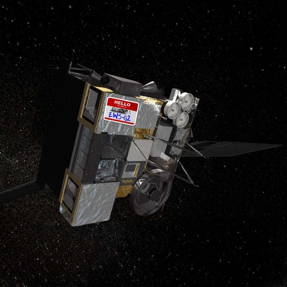
GOES-15
NOAA’s Sentinel Over the Pacific Skies
Quick Reader
| Attribute | Details |
|---|---|
| Mission Name | GOES-15 |
| Full Form | Geostationary Operational Environmental Satellite-15 |
| Operating Agency | NOAA (USA) |
| Built By | Boeing Satellite Systems |
| Mission Type | Operational weather satellite |
| Launch Date | 4 March 2010 |
| Launch Vehicle | Atlas V |
| Orbit Type | Geostationary orbit |
| Primary Coverage | Western United States & Pacific Ocean |
| Main Instruments | Imager, Sounder |
| Operational Role | Weather monitoring & forecasting |
| Mission Status | Retired (2020) |
In two sentences
GOES-15 was a key U.S. geostationary weather satellite that provided continuous monitoring of the western United States and the Pacific Ocean. It played a critical operational role in weather forecasting, storm tracking, and space-weather awareness.
Key takeaway
GOES-15 was not an experimental satellite—it was part of the daily decision-making backbone of modern meteorology.
Best for
Weather science, Earth observation, disaster preparedness, and satellite meteorology studies.
Introduction – Watching Earth Without Blinking
Weather does not wait.
Storms form, cyclones intensify, and atmospheric rivers move across oceans long before they reach land. To monitor these processes, meteorologists need satellites that never look away.
GOES-15 was built for exactly this role—providing continuous, real-time observation of Earth’s atmosphere from a fixed position in space. For over a decade, it quietly watched half of the planet’s weather systems unfold.
What Was GOES-15?
GOES-15 was an operational geostationary weather satellite, part of NOAA’s long-running GOES program.
Its primary responsibilities included:
Continuous cloud monitoring
Storm development tracking
Severe weather detection
Atmospheric temperature profiling
Support for aviation and marine safety
Unlike research missions, GOES-15 existed to serve daily forecasting needs.
Why Geostationary Orbit Matters for Weather
GOES-15 operated in geostationary orbit, meaning:
It orbited Earth once every 24 hours
It remained fixed over a specific longitude
It observed the same region continuously
This allowed meteorologists to track:
Storm growth minute by minute
Cyclone paths across oceans
Rapid weather changes impossible to capture from low-orbit satellites
For weather science, time continuity is more important than proximity.
Primary Coverage – The Pacific Guardian
GOES-15 primarily monitored:
The western United States
Alaska (during part of its mission)
The eastern Pacific Ocean
This made it essential for:
Pacific storm systems
Atmospheric river tracking
Tropical cyclone development
Aviation route safety
Many weather events affecting North America are born over the Pacific—GOES-15 watched them first.
Core Instruments on GOES-15
Imager
The Imager observed Earth in multiple spectral bands, including:
Visible
Infrared
Water vapor
It provided:
Cloud imagery
Storm intensity analysis
Sea surface temperature data
Day-night weather monitoring
Sounder
The Sounder measured vertical profiles of the atmosphere.
It enabled:
Temperature and moisture profiling
Stability analysis
Improved numerical weather prediction
This data was crucial for forecast accuracy, not just visualization.
Operational Importance of GOES-15
GOES-15 supported:
National Weather Service forecasting
Severe storm warnings
Hurricane monitoring
Aviation weather safety
Marine and coastal operations
Its data flowed directly into forecasting models and emergency alert systems—often without public visibility.
GOES-15 as Part of a System
GOES-15 was not alone.
It worked alongside:
Other GOES satellites covering different longitudes
Polar-orbiting weather satellites
Ground-based radar networks
Together, they formed an integrated global weather-monitoring system.
GOES-15 as Part of a System
GOES-15 was not alone.
It worked alongside:
Other GOES satellites covering different longitudes
Polar-orbiting weather satellites
Ground-based radar networks
Together, they formed an integrated global weather-monitoring system.
Why GOES-15 Was Reliable
GOES-15 earned its reputation through:
Long operational life
Stable instruments
Continuous calibration
Minimal downtime
For operational satellites, reliability is the highest achievement—and GOES-15 delivered it.
Why GOES-15 Still Matters Today
Although retired, GOES-15 matters because it:
Provided a long, continuous weather record
Supported climatological trend analysis
Set operational standards for later GOES satellites
Modern forecasting systems are built on the experience gained from satellites like GOES-15.
Tracking Severe Storms and Hurricanes
One of GOES-15’s most critical roles was the continuous monitoring of severe weather systems.
From geostationary orbit, it allowed meteorologists to:
Track storm development in real time
Monitor hurricane structure and movement
Observe cloud-top temperatures linked to storm intensity
Identify rapidly intensifying systems
This capability was essential for issuing timely warnings, especially for storms forming over the Pacific before reaching land.
Atmospheric Rivers – A New Focus in Forecasting
GOES-15 played an important role in studying atmospheric rivers—long, narrow bands of moisture responsible for extreme rainfall.
Its water-vapor imagery helped:
Track moisture transport from the Pacific
Identify landfall timing
Improve flood forecasting
These observations became increasingly important as climate-driven weather extremes intensified.
GOES-15 and Aviation Safety
Weather hazards pose serious risks to aviation.
GOES-15 supported aviation operations by:
Monitoring turbulence-producing cloud systems
Tracking volcanic ash plumes
Providing cloud-top height estimates
Supporting flight route planning over the Pacific
For trans-Pacific flights, GOES-15’s coverage was especially valuable.
GOES-15 vs GOES-R Series – A Generational Shift
GOES-15 represented the final generation of GOES-N/O/P satellites.
| Feature | GOES-15 | GOES-R Series |
|---|---|---|
| Role | Operational baseline | Advanced generation |
| Image Resolution | Moderate | Much higher |
| Scan Speed | Slower | Rapid refresh |
| Spectral Channels | Fewer | Many more |
| Lightning Detection | Not available | Integrated |
Interpretation
GOES-15 provided reliability.
GOES-R satellites provide precision and speed.
How GOES-15 Improved Forecast Accuracy
GOES-15 data fed directly into:
Numerical weather prediction models
Short-term nowcasting systems
Severe storm warning algorithms
Continuous updates improved model initialization—one of the most critical factors in accurate forecasting.
Space Weather Monitoring
Although primarily a weather satellite, GOES-15 also contributed to space weather awareness.
Its instruments helped monitor:
Solar X-ray flux
Geomagnetic disturbances
Conditions affecting satellite operations and power grids
This made GOES-15 part of a broader space-environment monitoring network.
Operational Challenges and Longevity
Operating continuously in geostationary orbit presents challenges:
Radiation exposure
Thermal cycling
Component aging
Despite these, GOES-15 operated reliably for over a decade—meeting and exceeding mission expectations.
Why GOES-15 Was Trusted by Forecasters
GOES-15 earned trust because:
Its data stream was consistent
Calibration remained stable
Coverage was uninterrupted
For operational forecasting, dependability matters more than novelty.
GOES-15’s Contribution to Climate Records
Beyond daily forecasting, GOES-15 data contributed to:
Long-term cloud climatology
Sea surface temperature trends
Atmospheric circulation studies
These records are vital for understanding climate variability.
Mission Transition, Standby Role, and Retirement
GOES-15 completed its primary operational role after more than a decade of service.
Key milestones:
Operated as the GOES-West satellite for many years
Later reassigned to standby and backup roles
Supported continuity during the transition to the GOES-R series
Officially retired in 2020
After retirement, GOES-15 was moved to a graveyard orbit, ensuring responsible space operations and orbital safety.
GOES-15’s Long-Term Legacy
GOES-15’s importance lies in its reliability rather than novelty.
Its legacy includes:
Continuous weather coverage of the Pacific region
Improved storm and hurricane forecasting
Strengthening operational confidence in geostationary monitoring
Providing a long, stable climate and weather data record
Many forecasting improvements of the 2010s were built directly on GOES-15 data.
From GOES-15 to the GOES-R Era
GOES-15 represented the end of a mature generation.
Lessons learned from its operation influenced:
GOES-16 (GOES-East)
GOES-17 and GOES-18 (GOES-West successors)
These newer satellites introduced:
Faster imaging refresh rates
Higher spatial and spectral resolution
Advanced lightning and space-weather sensors
GOES-15 was the bridge between traditional geostationary meteorology and the modern, high-speed era.
Why GOES-15 Still Matters Today
Even after retirement, GOES-15 remains relevant because:
Its data supports long-term climate analysis
Historical weather events rely on its records
Model validation depends on consistent datasets
In meteorology, continuity is as valuable as innovation.
Frequently Asked Questions (FAQ)
What was GOES-15 primarily used for?
GOES-15 was used for continuous weather monitoring, storm tracking, hurricane observation, aviation support, and Pacific-region forecasting.
Why was GOES-15 placed in geostationary orbit?
Geostationary orbit allowed GOES-15 to continuously observe the same region, enabling real-time tracking of rapidly evolving weather systems.
How long did GOES-15 operate?
GOES-15 operated from 2010 to 2020, serving over a decade in operational and backup roles.
Is GOES-15 still active today?
No.
GOES-15 was officially retired and moved to a graveyard orbit in 2020.
What replaced GOES-15?
GOES-15 was replaced by newer GOES-R series satellites, including GOES-17 and GOES-18, which provide significantly enhanced capabilities.
Did GOES-15 help with hurricane forecasting?
Yes.
GOES-15 played a critical role in monitoring Pacific hurricanes and storms before they approached land.
Why is GOES-15 important for Universe Map readers?
GOES-15 demonstrates how space-based observation directly supports daily life by improving weather forecasts, disaster preparedness, and climate understanding.
GOES-15 in the Context of Earth Observation
GOES-15 represents the operational backbone of modern meteorology.
It shows that:
Continuous observation saves lives
Reliability enables trust in forecasts
Space infrastructure quietly underpins global safety
Without satellites like GOES-15, modern weather prediction would not be possible.
Related Topics for Universe Map
GOES-R Series
Geostationary Satellites
Earth Observation
Hurricane Monitoring
Atmospheric Rivers
Space Weather
Together, these topics explain how Earth-focused space missions protect society.
Final Perspective
GOES-15 was not designed to explore the distant universe.
Its mission was closer—and more urgent.
By watching Earth’s atmosphere without interruption, GOES-15 became a silent guardian over the Pacific, helping forecasters anticipate storms, protect aviation, and warn communities in harm’s way.
Its success proves that some of the most important space missions are those that never look away from home.