


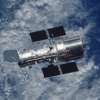


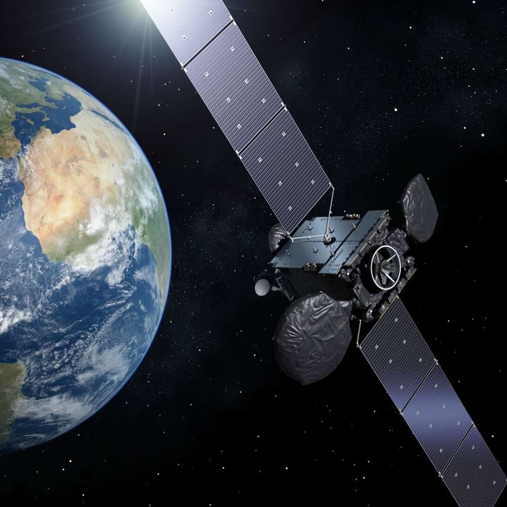
Geostationary satellites
The Silent Infrastructure Above Earth
Quick Reader
| Attribute | Details |
|---|---|
| Orbit Type | Geostationary Earth Orbit (GEO) |
| Orbital Altitude | ~35,786 km above Earth’s equator |
| Orbital Period | 24 hours (matches Earth’s rotation) |
| Apparent Motion | Fixed relative to Earth’s surface |
| Inclination | ~0° (equatorial orbit) |
| Primary Uses | Communication, weather, navigation support |
| Coverage | ~1/3 of Earth per satellite |
| Typical Lifespan | 10–15 years |
| Key Operators | NASA, ESA, ISRO, NOAA, private operators |
Scientific & Operational Role
Geostationary satellites form the backbone of real-time global monitoring, enabling continuous communication, weather forecasting, and disaster response.
Why It Matters
Without geostationary satellites, modern society would lose live television broadcasts, real-time weather tracking, continuous internet backbones, and large-scale emergency coordination.
Introduction – What Makes a Satellite “Geostationary”?
A geostationary satellite is not defined by what it does—but by how it moves.
Placed in a precise orbit above Earth’s equator, a geostationary satellite circles the planet at exactly the same rate that Earth rotates. The result is remarkable:
The satellite appears motionless in the sky.
This unique property allows a single satellite to provide continuous coverage of the same region, something no low-orbit satellite can achieve.
The Physics Behind Geostationary Orbit
Achieving a geostationary orbit requires a precise balance between:
Earth’s gravity pulling the satellite inward
Orbital velocity pushing it outward
Only one altitude satisfies this balance for a 24-hour orbital period.
Key requirements:
Circular orbit
Zero inclination (equatorial)
Exact orbital speed
Any deviation causes the satellite to drift, requiring constant correction.
This makes GEO one of the most demanding and valuable orbital regimes in space.
Why Geostationary Orbit Exists Only Above the Equator
A true geostationary orbit must lie directly above Earth’s equator.
If a satellite:
Is tilted relative to the equator
Has an elliptical orbit
It will appear to move north–south or east–west in the sky.
Such satellites are called geosynchronous, not geostationary.
This distinction matters because:
Ground antennas for GEO satellites can remain fixed
Tracking systems become simpler and more reliable
Coverage Advantage – One Satellite, One-Third of Earth
At GEO altitude, a satellite can “see” a vast portion of the planet.
This allows:
Continuous regional coverage
Persistent observation of weather systems
Stable communication links
In practice:
Three GEO satellites can cover most of Earth
Polar regions remain less visible due to geometry
This coverage efficiency is why GEO remains indispensable despite newer satellite constellations.
Primary Applications of Geostationary Satellites
Communications
Television broadcasting
International phone and data links
Internet backhaul
Weather Monitoring
Continuous storm tracking
Cyclone and hurricane observation
Cloud motion and temperature mapping
Disaster Management
Early warning systems
Real-time environmental monitoring
Emergency communication support
These applications require persistence, not speed—making GEO ideal.
Why Geostationary Satellites Are So Valuable
Geostationary satellites are valuable because they:
Provide uninterrupted service
Simplify ground infrastructure
Enable real-time monitoring
Unlike low-Earth orbit systems, GEO satellites do not need constant handoffs between ground stations. Once locked in position, they become permanent space-based infrastructure.
The Cost of Staying Still
Remaining “fixed” is deceptively difficult.
Geostationary satellites must constantly:
Counter gravitational pulls from the Moon and Sun
Correct solar radiation pressure
Maintain precise orientation
This requires onboard fuel, which ultimately limits mission lifespan.
When fuel runs out, satellites are moved to graveyard orbits above GEO to avoid collisions.
Why Geostationary Satellites Still Matter in the Age of LEO Constellations
Despite the rise of low-Earth orbit mega-constellations, GEO satellites remain unmatched for:
Continuous regional coverage
Broadcast reliability
Long-term monitoring
Rather than being replaced, GEO and LEO systems are increasingly complementary.
Geostationary vs Geosynchronous vs LEO – Clearing the Confusion
These three terms are often used interchangeably, but they describe very different orbital behaviors.
Key Distinctions Explained
| Feature | Geostationary (GEO) | Geosynchronous | Low Earth Orbit (LEO) |
|---|---|---|---|
| Orbital Period | 24 hours | ~24 hours | 90–120 minutes |
| Apparent Motion | Fixed in sky | Figure-8 motion | Rapid motion |
| Orbit Inclination | 0° (equatorial) | Can be inclined | Any |
| Altitude | ~35,786 km | ~35,786 km | 160–2,000 km |
| Ground Antenna | Fixed | Tracking required | Continuous tracking |
| Typical Use | TV, weather, comms | Specialized comms | Imaging, broadband |
Interpretation
All geostationary satellites are geosynchronous, but not all geosynchronous satellites are geostationary. GEO is the strictest and most valuable form of Earth orbit.
Why GEO Is Technically Challenging
Placing a satellite in GEO is not just about altitude—it requires precision in every orbital parameter.
Challenges include:
Achieving near-zero inclination
Circularizing the orbit precisely
Matching Earth’s rotational period exactly
Even small errors cause:
East–west drift
North–south oscillation
Increased fuel consumption for correction
This is why GEO missions demand:
Powerful launch vehicles
Careful orbital insertion
Long-term station-keeping strategies
Station-Keeping – Fighting Invisible Forces
A geostationary satellite is constantly pushed off position by subtle forces.
Key perturbations:
Gravitational pull from the Moon and Sun
Earth’s non-uniform gravity field
Solar radiation pressure
To counter these, satellites perform station-keeping maneuvers:
East–west control to maintain longitude
North–south control to maintain equatorial alignment
Fuel used for station-keeping ultimately determines the satellite’s operational lifetime.
Orbital Slots – Why GEO Is Politically and Economically Valuable
Because GEO satellites must remain fixed relative to Earth, orbital slots are limited.
Key facts:
Satellites must be spaced to avoid interference
Prime longitudes are highly contested
International coordination is required
The International Telecommunication Union (ITU) regulates:
Orbital slot allocation
Frequency usage
Interference prevention
This turns GEO into:
A strategic resource
An economic asset
A geopolitical consideration
Orbital Crowding – A Growing Concern
GEO is becoming increasingly crowded.
Current challenges:
Aging satellites occupying valuable slots
Limited maneuverability near end of life
Risk of radio interference
Unlike LEO, debris in GEO:
Remains for centuries
Is extremely difficult to remove
Can permanently block orbital slots
This makes responsible end-of-life management critical.
Graveyard Orbits – Cleaning Up GEO
When a geostationary satellite reaches the end of its life, it is moved to a graveyard orbit.
Key characteristics:
Located ~300 km above GEO
Safely removed from operational slots
Requires remaining fuel for transfer
This practice:
Protects active satellites
Preserves orbital infrastructure
Is now an international best practice
Failure to comply can permanently reduce GEO usability.
Why GEO Satellites Are Expensive
Compared to LEO satellites, GEO platforms are:
Larger and heavier
More complex
Designed for long lifespans
Cost drivers include:
Powerful launch vehicles
Redundant onboard systems
Radiation-hardened electronics
However, the return is stability:
Continuous service
Predictable performance
Decades of operational value
Why GEO and LEO Are Not Competitors
A common misconception is that LEO constellations will replace GEO.
In reality:
LEO excels at low-latency broadband
GEO excels at persistent coverage
Examples:
Weather satellites require GEO persistence
Live broadcasting benefits from fixed positioning
Modern space infrastructure increasingly uses hybrid GEO–LEO systems.
Major Geostationary Satellite Missions – Real-World Examples
Geostationary satellites are not experimental systems; they are core operational assets used daily across the world.
Weather Satellites
GOES (USA) – Continuous monitoring of storms, hurricanes, and atmospheric dynamics
Meteosat (Europe) – Long-term climate and weather observation over Europe and Africa
INSAT (India) – Weather forecasting, cyclone tracking, and disaster warnings
These satellites rely on GEO’s persistence to track evolving weather systems in real time.
Communication Satellites
INTELSAT – Global telecommunications backbone
SES / Eutelsat – Television broadcasting and data relay
INSAT / GSAT series – National communications and emergency services
Their fixed position allows ground antennas to remain permanently aligned, ensuring uninterrupted service.
Environmental and Disaster Monitoring
Geostationary satellites enable:
Continuous wildfire detection
Volcanic ash tracking
Flood and cyclone monitoring
Emergency communication during disasters
Without GEO satellites, early warning systems would lose critical time resolution.
Why Weather Satellites Depend on GEO
Weather is dynamic, not instantaneous.
GEO satellites allow:
Continuous imaging every few minutes
Motion tracking of clouds and storms
Accurate prediction of cyclone paths
Low-Earth orbit satellites pass quickly overhead, but GEO satellites stay and watch, making them irreplaceable for meteorology.
Geostationary Satellites and Earth Observation Limits
Despite their strengths, GEO satellites have limitations.
Key constraints:
Lower spatial resolution compared to LEO
Poor visibility of polar regions
Long communication latency
This is why:
High-detail imaging uses LEO
Polar observation relies on polar orbits
GEO focuses on persistence, not detail
Each orbit serves a different observational role.
Frequently Asked Questions (FAQ)
Can a geostationary satellite observe the entire Earth?
No. Each satellite covers about one-third of Earth and has limited visibility of the polar regions.
Why are geostationary satellites always above the equator?
Only an equatorial orbit allows a satellite to remain fixed over a single point on Earth’s surface.
Do geostationary satellites move at all?
They orbit Earth continuously, but their motion matches Earth’s rotation, making them appear stationary.
Why is there a delay in GEO satellite communication?
Signals must travel ~36,000 km each way, causing noticeable latency compared to LEO systems.
What happens when a GEO satellite runs out of fuel?
It is moved to a graveyard orbit to free its operational slot.
Will GEO satellites become obsolete?
No. They remain essential for weather monitoring, broadcasting, and continuous regional coverage.
The Future of Geostationary Orbit
GEO is evolving, not declining.
Future trends include:
High-throughput GEO satellites with advanced antennas
Electric propulsion to extend mission life
Improved station-keeping efficiency
Integration with LEO constellations
Rather than being replaced, GEO satellites are becoming more specialized and more powerful.
Why Geostationary Satellites Are Strategic Infrastructure
Geostationary satellites are:
Economically critical
Technologically demanding
Geopolitically significant
Control over GEO assets influences:
National communications
Weather forecasting accuracy
Disaster response capability
For this reason, GEO is often described as orbital real estate—limited, valuable, and carefully managed.
What We Would Lose Without Geostationary Satellites
Without GEO satellites:
Live global broadcasting would collapse
Real-time storm tracking would vanish
Emergency communication would be unreliable
Large-scale coordination during disasters would be severely impaired
Modern civilization depends on GEO far more than most people realize.
Related Topics for Universe Map
Low Earth Orbit (LEO)
Geosynchronous Orbit
Weather Satellites
Satellite Communication
Orbital Mechanics
Space Debris and Orbital Management
Together, these topics explain how Earth’s space environment supports daily life on the ground.
Final Perspective
Geostationary satellites do not explore distant worlds—but they quietly hold modern society together.
Hovering high above the equator, they watch storms form, carry voices across continents, relay emergency signals, and maintain the rhythm of global communication.
They are not dramatic, fast, or visible to the naked eye.
Yet without them, the modern world would feel suddenly disconnected, uncoordinated, and blind.
Geostationary satellites are proof that in space, sometimes the most powerful motion is standing perfectly still.