


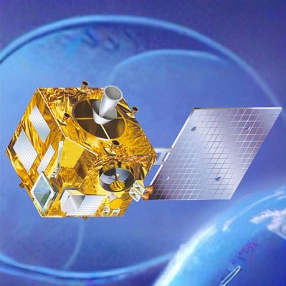
Kalpana-1
India’s First Dedicated Meteorological Satellite
Quick Reader
| Attribute | Details |
|---|---|
| Mission Name | Kalpana-1 |
| Original Name | METSAT-1 |
| Space Agency | ISRO (Indian Space Research Organisation) |
| Mission Type | Meteorological & weather observation satellite |
| Launch Date | 12 September 2002 |
| Launch Vehicle | PSLV-C4 |
| Orbit Type | Geostationary orbit |
| Orbital Longitude | ~74° East |
| Primary Role | Weather monitoring & cyclone tracking |
| Main Instruments | VHRR, DRT |
| Mission Status | Decommissioned (2011) |
In two sentences
Kalpana-1 was India’s first dedicated meteorological satellite, marking a major milestone in the country’s space-based weather forecasting capabilities. Operating from geostationary orbit, it provided continuous monitoring of the Indian subcontinent and surrounding oceans.
Key takeaway
Kalpana-1 transformed India from a weather-data consumer into a weather-data producer.
Best for
Meteorology students, Earth observation studies, disaster management research, and space history readers.
Introduction – A Satellite Built to Watch Earth Breathe
Weather is not just clouds and rain—it is a complex, dynamic system that shapes agriculture, disaster preparedness, and human safety.
Before Kalpana-1, India relied heavily on foreign satellites for critical weather data.
Kalpana-1 changed that reality.
It gave India continuous, real-time eyes on its atmosphere, enabling better cyclone warnings, monsoon tracking, and long-range forecasting.
What Was Kalpana-1?
Kalpana-1 was a geostationary meteorological satellite designed to:
Continuously observe weather systems
Track cyclones and storms
Monitor cloud cover and atmospheric motion
Relay data from remote weather stations
Unlike low-Earth-orbit satellites, Kalpana-1 remained fixed over the same region, making it ideal for persistent weather monitoring.
Why Geostationary Orbit Was Essential
Kalpana-1 operated from geostationary orbit, meaning:
It orbited Earth once every 24 hours
It stayed fixed relative to the Indian subcontinent
It provided uninterrupted regional coverage
This allowed meteorologists to observe:
Cyclone formation in the Indian Ocean
Monsoon cloud movement
Day-night weather evolution
For weather forecasting, continuity matters more than resolution—and Kalpana-1 delivered that continuity.
Instruments Onboard Kalpana-1
VHRR – Very High Resolution Radiometer
The VHRR instrument observed Earth in:
Visible
Infrared
Water-vapor bands
It enabled:
Cloud imaging
Sea surface temperature measurement
Cyclone intensity estimation
Night-time weather observation
DRT – Data Relay Transponder
The DRT allowed Kalpana-1 to:
Collect data from automatic weather stations
Relay information from remote and oceanic regions
Support disaster-warning systems
This made Kalpana-1 a communication bridge between Earth-based sensors and forecasting centers.
Why Kalpana-1 Was a Turning Point for India
Kalpana-1 represented more than a satellite—it represented strategic independence.
Its impact included:
Faster cyclone warnings
Improved monsoon analysis
Reduced dependence on foreign data
Strengthened disaster management systems
It laid the groundwork for India’s modern meteorological satellite fleet.
The Name “Kalpana” – A Tribute
Originally called METSAT-1, the satellite was later renamed Kalpana-1 in honor of Kalpana Chawla, the Indian-born astronaut who lost her life in the Space Shuttle Columbia disaster.
The name symbolizes:
Scientific aspiration
Human courage
India’s connection to global space exploration
Limitations of Kalpana-1
As a first-generation system, Kalpana-1 had constraints:
Limited spectral channels
Lower resolution compared to modern satellites
Aging electronics over time
Despite these, it consistently delivered valuable data for nearly a decade.
Why Kalpana-1 Still Matters Today
Kalpana-1 matters because it:
Established India’s meteorological satellite capability
Created operational experience for later missions
Enabled progress toward advanced systems like INSAT-3D
Every modern Indian weather satellite traces its operational heritage back to Kalpana-1.
Cyclone Tracking – Saving Lives Through Early Warning
One of Kalpana-1’s most critical contributions was real-time cyclone monitoring over the Indian Ocean.
From geostationary orbit, the satellite enabled meteorologists to:
Track cyclone formation from its earliest stages
Monitor storm movement, size, and structure
Estimate cyclone intensity using cloud patterns and infrared data
Issue earlier and more accurate warnings
This capability significantly improved India’s disaster preparedness, especially for coastal regions vulnerable to cyclones.
Monsoon Monitoring – Understanding India’s Lifeline
The Indian monsoon is one of the most complex weather systems on Earth.
Kalpana-1 helped scientists:
Observe monsoon cloud dynamics continuously
Track the onset and withdrawal of monsoon systems
Study large-scale atmospheric circulation patterns
Improve seasonal rainfall forecasting
Because the satellite could observe the same region day and night, it captured monsoon evolution in real time, not just snapshots.
Sea Surface Temperature and Weather Systems
Kalpana-1’s infrared sensors measured sea surface temperatures (SST)—a key driver of weather.
These measurements supported:
Cyclone intensity prediction
Monsoon strength analysis
Ocean–atmosphere interaction studies
Warm ocean surfaces fuel storms, and Kalpana-1 helped identify regions where dangerous weather was likely to intensify.
Disaster Management and Emergency Response
Kalpana-1 played a vital role in national disaster response systems.
Its data supported:
Early warnings for floods and severe storms
Coordination between meteorological agencies and disaster authorities
Faster dissemination of alerts to vulnerable regions
The satellite contributed directly to reducing loss of life, even if its role often went unnoticed by the public.
Kalpana-1 vs Later Indian Weather Satellites
Kalpana-1 laid the foundation for more advanced systems.
| Feature | Kalpana-1 | INSAT-3D / INSAT-3DR |
|---|---|---|
| Generation | First dedicated | Advanced |
| Spectral Channels | Limited | Multiple enhanced channels |
| Resolution | Moderate | High |
| Data Products | Basic weather | Advanced forecasting models |
| Role | Capability proof | Operational excellence |
Interpretation
Kalpana-1 proved that India could do it.
Later satellites perfected how well it could be done.
Operational Challenges in Geostationary Orbit
Operating a weather satellite in geostationary orbit presents unique challenges:
Continuous exposure to radiation
Thermal stress over long durations
Fuel management for station-keeping
Kalpana-1 successfully operated for nearly nine years, exceeding many expectations for a first-generation mission.
Contribution to Atmospheric Science
Beyond daily forecasting, Kalpana-1 data was used for:
Climate trend analysis
Cloud physics studies
Atmospheric motion vector calculations
Validation of numerical weather prediction models
This helped strengthen India’s scientific research base in atmospheric sciences.
Why Kalpana-1 Was a Strategic Success
Kalpana-1 demonstrated that:
Indigenous meteorological satellites were feasible
Continuous weather monitoring was operationally sustainable
India could independently support critical national forecasting needs
It marked a shift from reliance to self-reliance in space-based weather observation.
Kalpana-1’s Place in Global Meteorology
Although regional in coverage, Kalpana-1 contributed data to global meteorological networks.
Its observations complemented:
Other geostationary satellites
Polar-orbiting weather missions
International forecasting models
This made Kalpana-1 part of the global weather-monitoring system, not just a national asset.
Mission End and Decommissioning
Kalpana-1 operated reliably for nearly nine years, a strong achievement for a first-generation meteorological satellite.
Key end-of-mission points:
Fuel limitations gradually reduced station-keeping capability
Instrument performance declined with age
Regular data operations ended in 2011
After decommissioning, Kalpana-1 was moved to a graveyard orbit, following responsible space operations practice.
Kalpana-1’s Long-Term Legacy
Kalpana-1’s true impact is measured not by how long it operated, but by what it enabled next.
Its legacy includes:
Establishing India’s independent weather-observation capability
Building operational expertise in geostationary meteorology
Creating confidence for more advanced missions
Strengthening disaster preparedness and early-warning systems
Every modern Indian meteorological satellite stands on the foundation Kalpana-1 created.
From Kalpana-1 to Today’s Advanced Weather Fleet
Kalpana-1 directly influenced the development of:
INSAT-3D
INSAT-3DR
GISAT / EOS-series Earth observation missions
These later satellites introduced:
Higher spatial resolution
More spectral channels
Improved atmospheric profiling
Advanced data products for forecasting models
Kalpana-1 was the proof of capability—its successors delivered refinement and scale.
Why Kalpana-1 Still Matters in the Data Era
Even though Kalpana-1 is no longer operational:
Its historical datasets remain valuable
Long-term climate analysis relies on early baseline data
Meteorological trends require continuity
Past data enables present understanding. In weather science, history is context.
Kalpana-1 in the Context of Disaster Risk Reduction
Kalpana-1’s most human-centered contribution was its role in saving lives.
By improving:
Cyclone detection timing
Storm path prediction
Warning dissemination
It directly supported better evacuation planning and emergency response.
Its impact was felt most strongly where technology meets public safety.
Frequently Asked Questions (FAQ)
What was Kalpana-1 used for?
Kalpana-1 was used for continuous weather monitoring, cyclone tracking, monsoon observation, and data relay from remote weather stations across India and surrounding regions.
Why was Kalpana-1 placed in geostationary orbit?
Geostationary orbit allowed Kalpana-1 to continuously observe the same region, which is essential for real-time weather monitoring and storm tracking.
How long did Kalpana-1 operate?
Kalpana-1 operated from 2002 to 2011, providing nearly nine years of meteorological data.
Why was METSAT-1 renamed Kalpana-1?
The satellite was renamed in honor of Kalpana Chawla, the Indian-born astronaut who died in the Space Shuttle Columbia disaster, as a tribute to her contribution to space exploration.
Did Kalpana-1 help with cyclone warnings?
Yes.
Kalpana-1 significantly improved early cyclone detection and tracking, helping meteorological agencies issue more timely and accurate warnings.
Is Kalpana-1 still operational today?
No.
The satellite was officially decommissioned in 2011 after completing its mission life.
What replaced Kalpana-1?
More advanced Indian meteorological satellites such as INSAT-3D and INSAT-3DR replaced Kalpana-1, offering improved resolution and forecasting capabilities.
Kalpana-1 in the Broader History of Space Technology
Kalpana-1 represents a key transition point:
From dependence to independence
From experimental to operational space systems
From limited forecasting to modern, data-driven meteorology
It shows how space technology directly improves daily life—not through exploration alone, but through practical, continuous service.
Related Topics for Universe Map
Geostationary Satellites
INSAT Satellite Series
Earth Observation
Cyclone Tracking
Monsoon Systems
Disaster Management Satellites
These topics together explain how space-based observation protects life on Earth.
Final Perspective
Kalpana-1 was not designed to explore distant galaxies or exotic physics.
Its mission was closer to home—and no less important.
By watching Earth’s atmosphere day and night, Kalpana-1 helped transform weather forecasting, disaster preparedness, and scientific self-reliance in India. Its success proved that space technology matters most when it quietly serves millions of people.
Kalpana-1 stands as a reminder that some of the most impactful space missions are those that never leave Earth’s view.